By David Gjestson
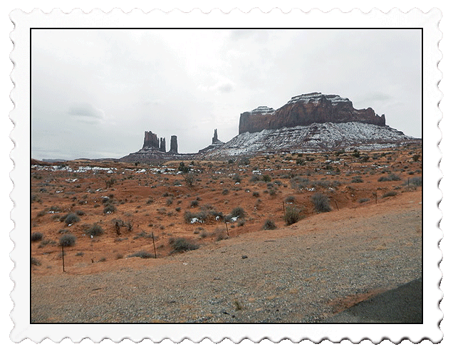
Monument Valley is a Navaho Tribal Park located in northeastern Arizona. It contains 30,000 acres and was established in 1958 but was at least 150 million years in the making as the eroded sediment from the Rocky Mountains deposited in this basin and were cemented into limestone and sandstone. The slow uplift of the Colorado Plateau 65 million years ago caused by the North American tectonic plate collision coupled with 65 million years of erosion produced this awesome environment.
There is no easy access to this park. The most expedient way is to fly into Phoenix, rent a car and endure an 5-hour drive north through Flagstaff and ultimately northeast to Monument Valley. There is ample camping and lodging in the area. The park itself offers camping and a series of cabins that offer a spectacular view of the park. A $20 fee is collected at the entrance gate. Hikers are required to register in the visitor center, and the entrance fee receipt is all that’s required to enjoy the 17-mile auto trail looping through the park.
Because I rather blindly made my motel reservation without a lot of research, my motel was three miles west of the park but had a splendid view of the area. Because Utah’s Valley of the Gods was just an hour north, I chose to tour there the day of my arrival to enable me to spend the entire second day at Monument Valley. I would hike the only public trail in the morning and use the auto-trail in the afternoon.
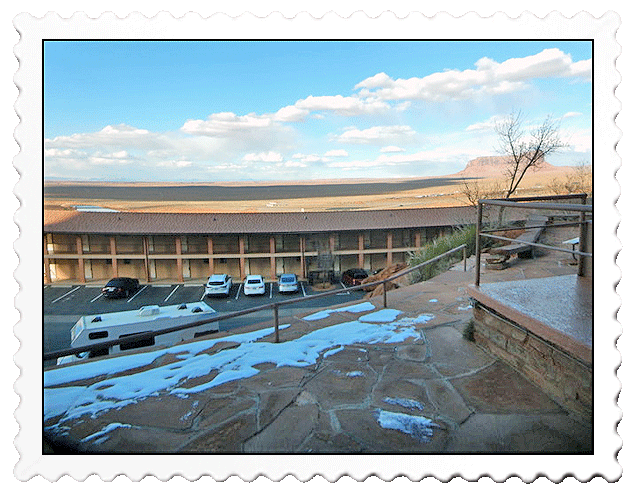
My morning view shed enjoying breakfast at Goulding’s Motel (rooms below)
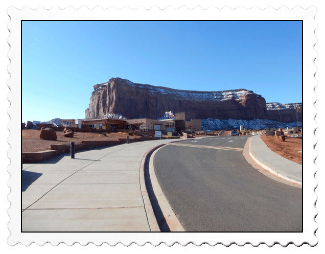
Arriving at the park at 8 a.m., the temperature was 28 degrees and I was elated I had chosen a comfortable motel rather than my normal preference to camp! I registered in the basement of the visitor center to hike the Wildcat Trail and briefly looked at very expensive Navaho merchandise on the second floor. I also had the option to sign up for a guided trail trip ($90) but since the vehicle used was simply a flat bed truck with seats in the back exposing riders to the elements, I passed!
The visitor center offered the usual park curios but also pricey Navaho pots and jewelry
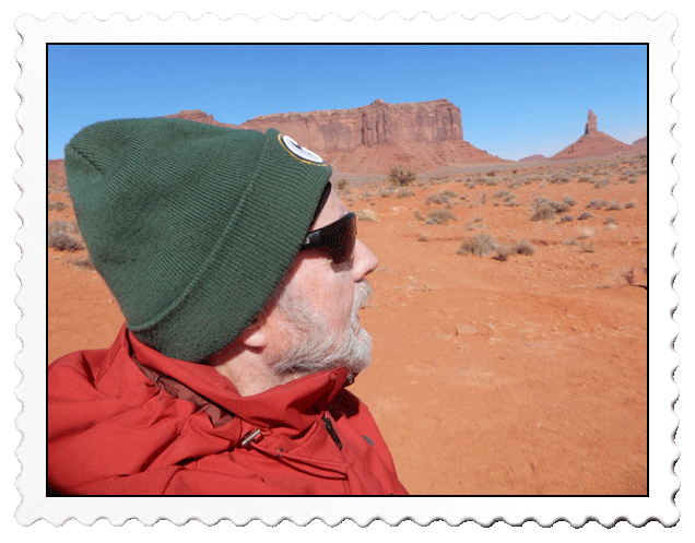
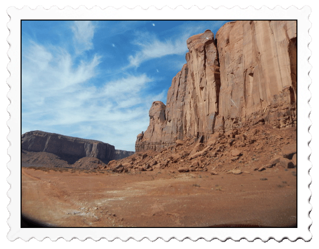
I was excited to hit the 3.3-mile trail as the sky was clear and the red desert surroundings were stunning to the eye. I hesitated donning my heavy winter coat rather than a much lighter puffer jacket but later congratulated myself when the cold desert breezes hit me! There were two couples signed in ahead of me and I saw them in the first few minutes on the trail. Obviously “tennis shoe hikers,” they took some pictures and left! I had the trail to myself.
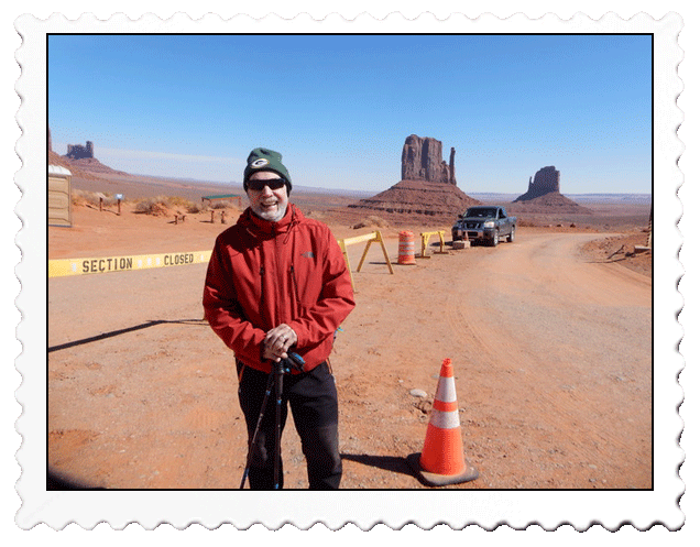
The Navaho gate keeper was happy to take my picture and suggested we go over to the trailhead shown over my left shoulder for better aesthetics. I passed not wanting to be a bother or appear “too touristy!"
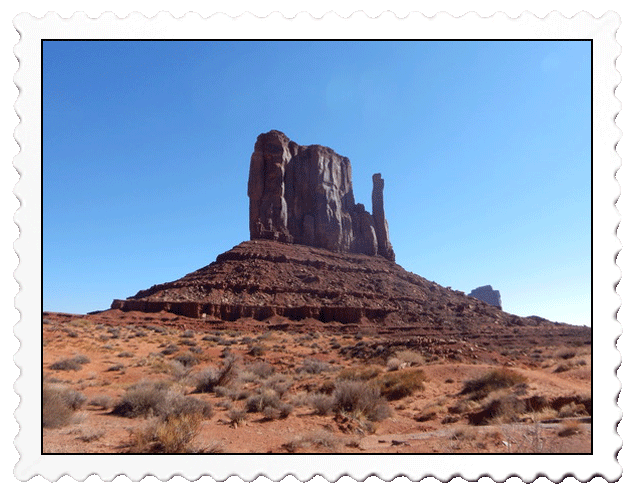
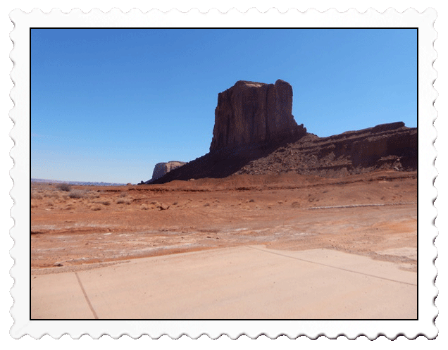
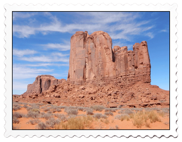
My objective was to loop around the West Mitten Butte
a mile and a half east of the trailhead
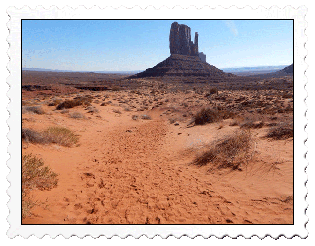
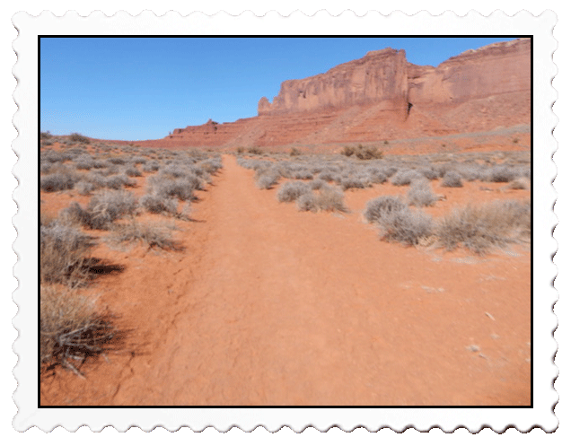
The Wildcat trail was quite distinct, well marked and litter free
indicating exemplary maintenance
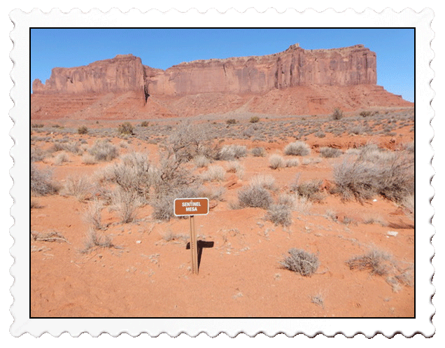
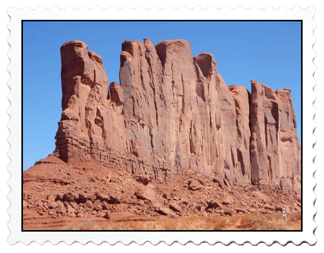
Sentinel Mesa (Spanish word for table) was massive! As it erodes, it becomes a butte (pronounced bee-ute).
When a butte erodes further, it becomes a spire.
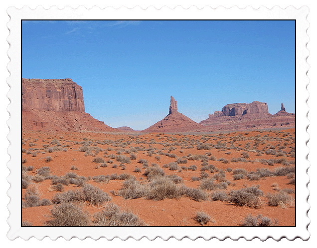
To the north of the trail were a mesa, a bluff and a spire I think called “The Bear and a Rabbit” (right),
“King on His Throne” (center), and "Brigham’s Tomb (left).
About half way around the West Mitten Butte, I stopped to listen and could only hear
a slight desert wind. No wildlife in sight, no people…dead silence. A good contemplation moment!
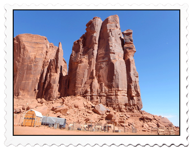
The trail back took me past Sentinel Mesa and a line of cabins just over the horizon.
Those cabins have a stunning view of the park’s aesthetics and amazing sunrises!
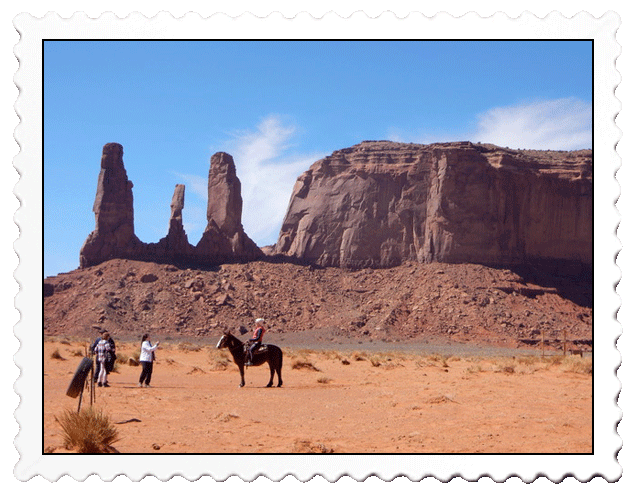
After a leisurely hike over 2 1/2 hours, I had a quick lunch and registered with a Navaho worker to experience the auto-trail. To maintain quality control, only 15 cars per hour were allowed to enter the trail, and I was told that some days in warmer weather, the wait could be as long as 4-5 hours! This day, I seldom had a car in my sight line in front or in the rearview mirror. Timing is everything, eh?
The auto-trail began with a view of the huge Mitchell Mesa
A picturesque area here was called John Ford’s Point
because it was his favorite scene
Rain God Mesa
This corral and a cluster on Navaho houses (off left) were clearly posted
“No Entry!"
North Window Overlook
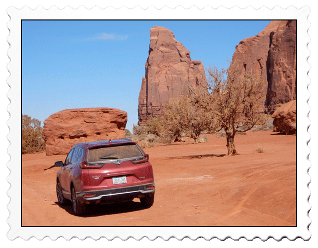
I stopped at Camel Butte to admire that large boulder in front of my Honda
One last look over my shoulder at "Rain God Mesa” (left)
and “Mitchell Mesa” (right) as I completed the auto-trail
Were those scenes familiar at all for you? They should be because many famous westerns were shot here and John Wayne was in a lot of them in movies directed by John Ford. John Wayne called the area, “God’s Treasure.” The films included:
- Kit Carson
- Stagecoach
- Billy the Kid
- My Darling Clementine
- Fort Apache
- She Wore a Yellow Ribbon
- The Searchers
- How the West Was Won
- The Trial of Billy Jack
- The Eiger Sanction
- The Legend of he Lone Ranger
- Back to the Future III
- Thelma and Louise